Log in
All resources
Create a design
476 Free Images of Maps Of Voyages
latin-language maps
dutch-language maps
baptista van doetecum
northern sea route
maps of novaya zemlya
old maps of the white sea
maps of the barents sea
third voyage of willem barentsz
16th-century maps of the arctic
old maps of spitsbergen
holiday
maps
third voyage of willem barentsz
16th-century maps of the arctic
holiday
maps
third voyage of willem barentsz
history of dutch sea fisheries
the voyage of the vega round asia and europe
third voyage of willem barentsz
third voyage of willem barentsz
16th-century maps of the arctic
maps
sea
135th meridian east
tasman map
holiday
maps
third voyage of willem barentsz
history of dutch sea fisheries
third voyage of willem barentsz
16th-century maps of the arctic
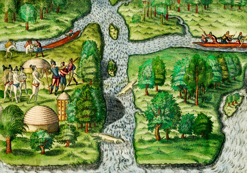
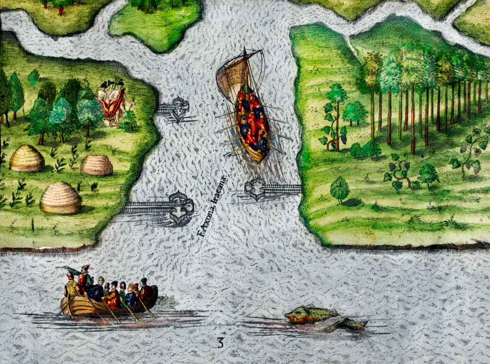
overwintering on nova zembla by willem barentsz, 1596-1597
maps in the rijksmuseum amsterdam
overwintering on nova zembla by willem barentsz, 1596-1597
maps in the rijksmuseum amsterdam
itinerario (jan huygen van linschoten)
latin-language maps
a voyage to terra australis
1814 engravings
old maps of spitsbergen
old maps of the arctic
travel
maps
medieval
maps
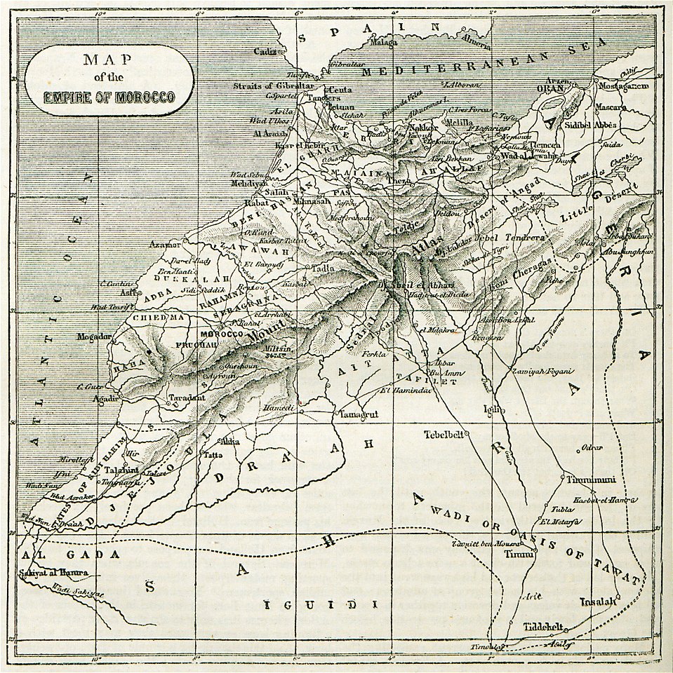
africa
maps
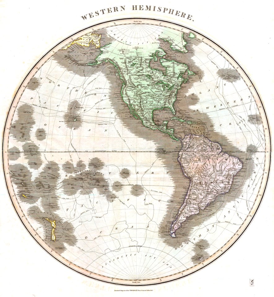
old maps of earth's hemispheres
maps of voyages
maps
blue
english-language maps
maps of voyages
old maps of the azores
azores
old maps of bologna
bologna in art
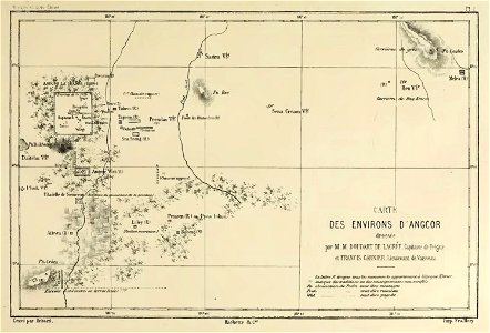
voyage d'exploration en indo-chine - (1885
francis garnier
maps in the library of congress
mao kun map
historical images of the cyclades
maps of mykonos
old maps of the dutch east india company
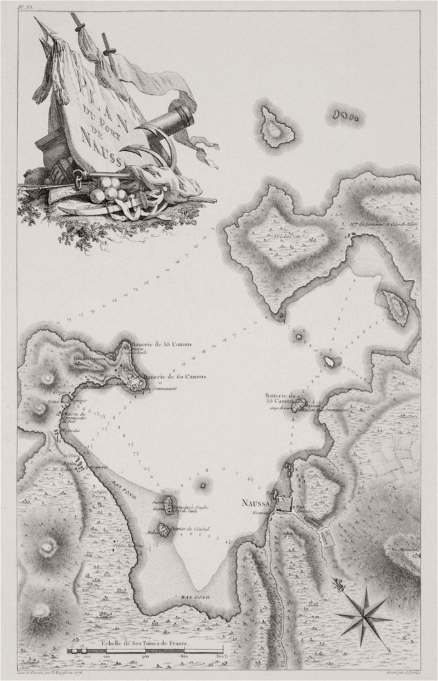
1787
old maps of greece
old maps of italy
maps showing 19th-century history
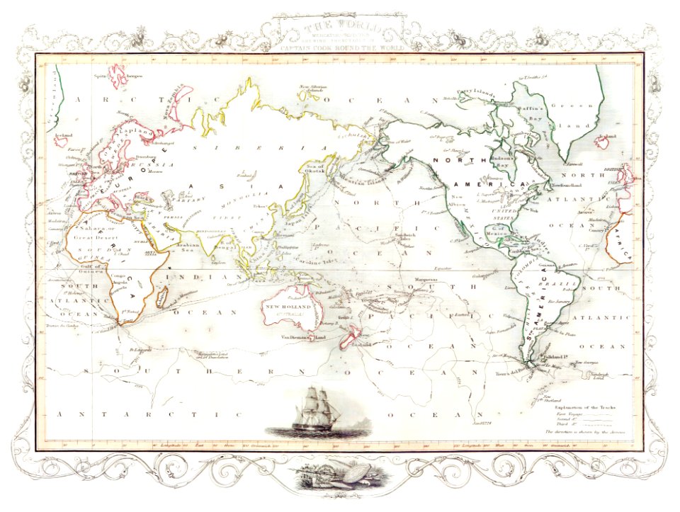
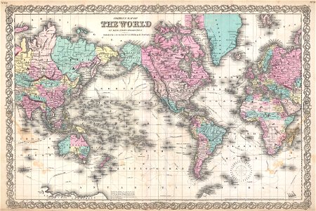
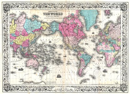
political maps of the world
old maps of the strait of magellan
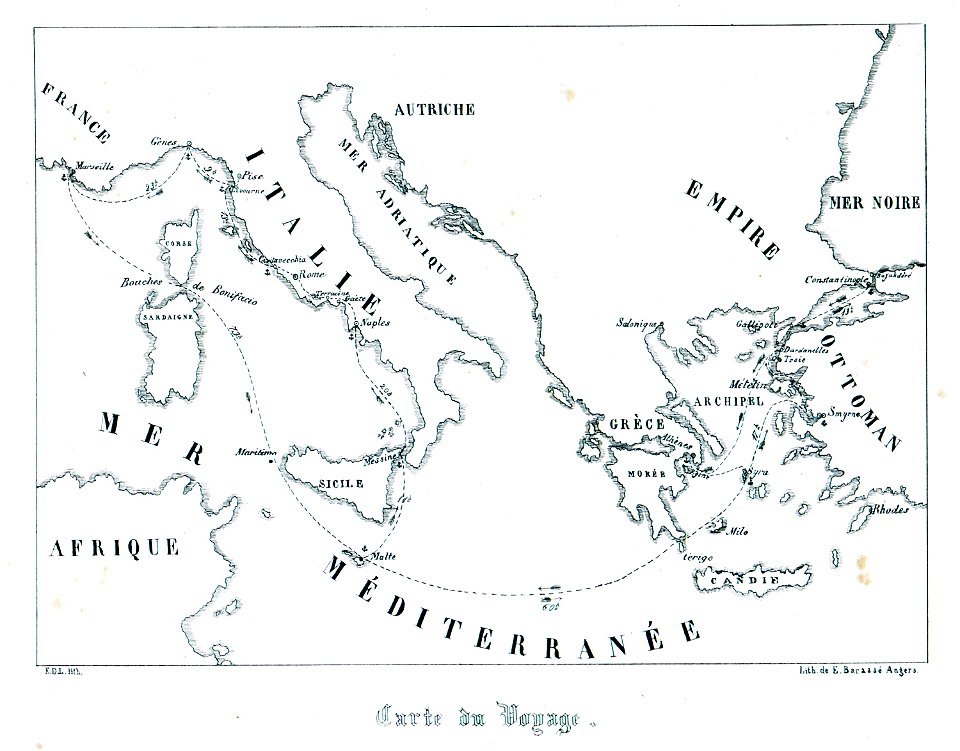
voyage au pôle sud
old maps of cyprus
cyprus in art
french-language maps
pictorial maps
medieval
maps
relation d'un voyage du levant 1718
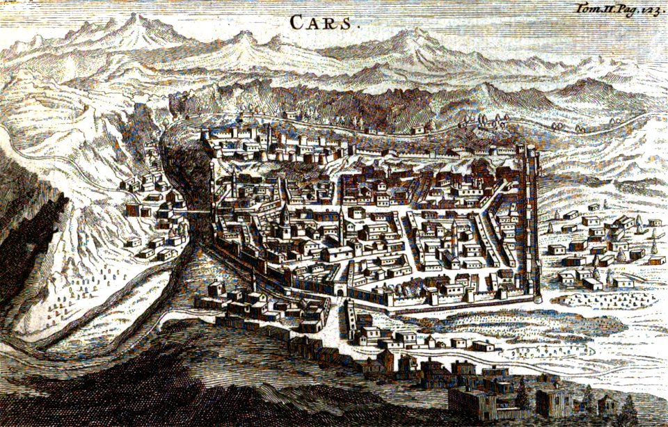
old pictures and maps of kars
political maps of the world
1852
maps of the south shetland islands
voyage au pôle sud
old maps of the strait of magellan
voyage au pôle sud
maps of the south orkney islands
voyage au pôle sud
voyage au levant (cornelis de bruijn)
maps of indochina
francis garnier
medieval
maps
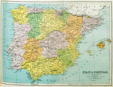
old maps of the iberian peninsula
1870 in spain
maps by jacques-nicolas bellin
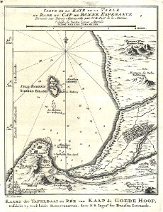
table bay
old maps of cambodia
francis garnier
tinco martinus lycklama à nijeholt (1837-1900)
unidentified maps
book illustration
old map
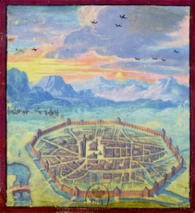
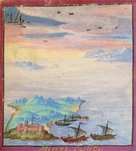
voyage pittoresque de la grèce
i̇zmir in the 18th century
kennebec river
maine
voyage pittoresque de la grèce
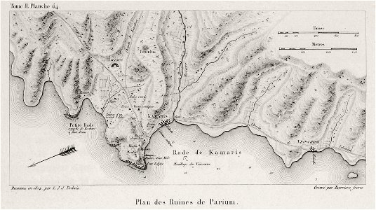
maps of troas
media in the houghton library
harvard university
voyage pittoresque de la grèce
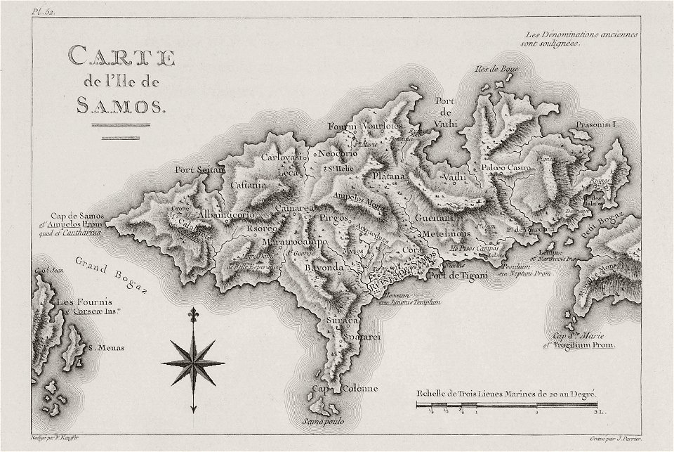
maps of samos
travels and adventures in all parts of the globe (1870)
all round the world: an illustrated record of voyages
travels and adventures in all parts of the globe (1870)
all round the world: an illustrated record of voyages
travel
maps
voyage pittoresque de la grèce
lemnos
voyage pittoresque de la grèce
maps of the sea of marmara
monochrome
tree
voyage pittoresque de la grèce
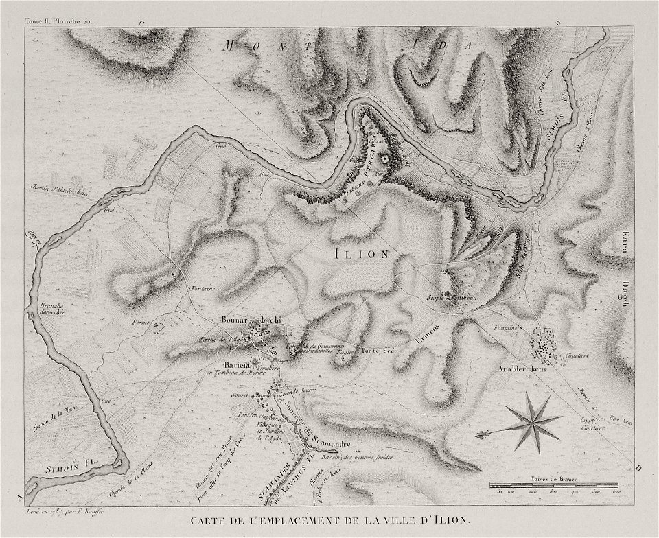
naoussa (paros)
voyage pittoresque de la grèce
maps of troas
voyage dans la macédoine (1831)
old maps of macedonia
voyage pittoresque de la grèce
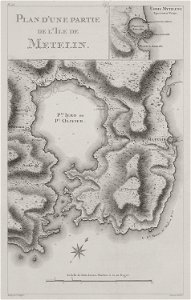
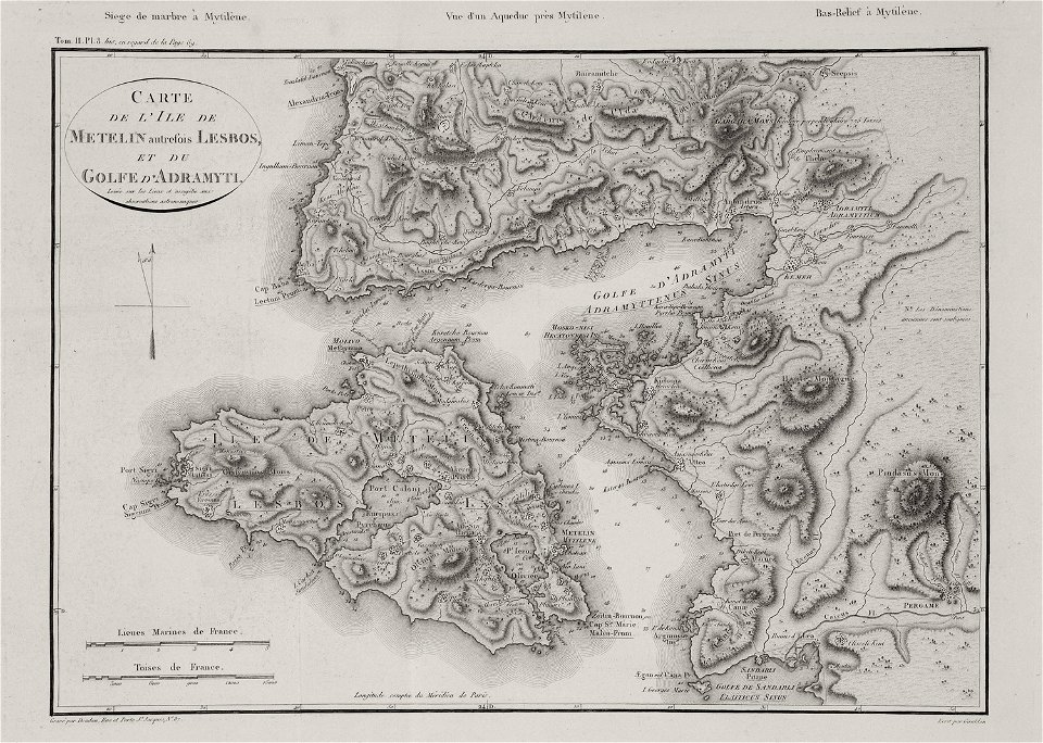
maps of lesbos
medieval
maps
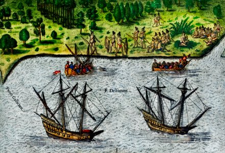
maps of voyages by christopher columbus
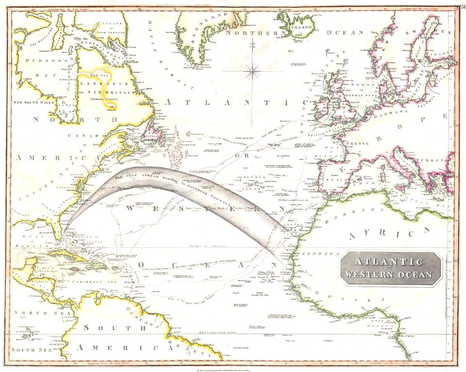
atlantic ocean
voyage pittoresque de la grèce
maps of lesbos
heaven
happy
background
maps
itinerario (jan huygen van linschoten)
latin-language maps
printing
1848
self-published work
sidewalk
2010 manhattan photos by jim.henderson
pages with maps
travel
maps
voyage pittoresque ou description des royaumes de naples et de sicilie
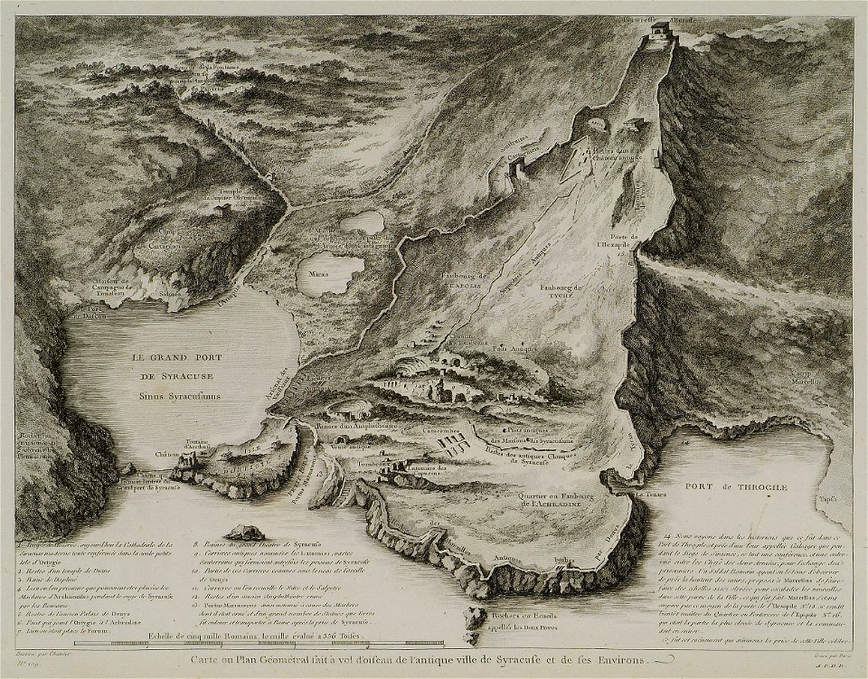
old maps of syracuse
background
maps
travel
health
self-published work
cc-pd-mark
landscape
maps
self-published work
vehicle
self-published work
pages with maps
symbol
maps
background
maps
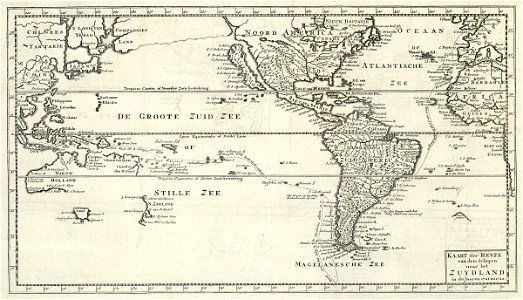
18th-century double hemisphere world maps
1720s maps of the world
maps of aboriginal australia
old maps of new south wales
the odyssey (butler)
maps of the odyssey
1590s maps of the world
1595 maps
maps of novaya zemlya
1590s maps
maps by jodocus hondius
1595 maps
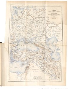
1855 maps of the russian empire
1850s maps of crimea
19th-century maps of the black sea
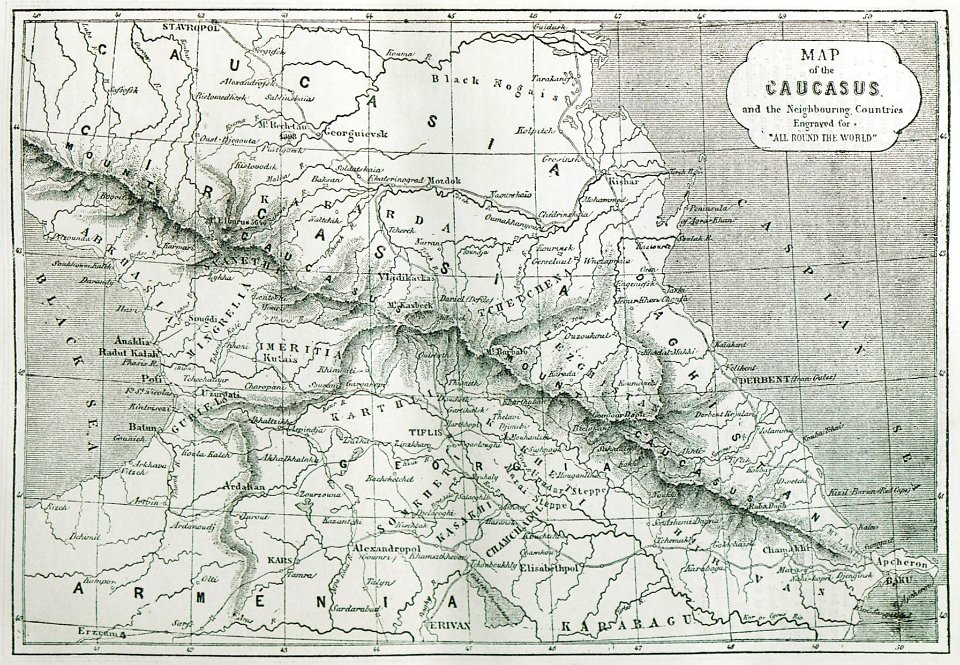
1870s maps of the caucasus
ferdinand von wrangel
peter anjou
ferdinand von wrangel
peter anjou
1630s maps of new york city
manatus map
eran laor cartographic collection
edward weller
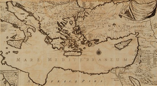
17th-century maps of the eastern mediterranean
andré daulier deslandes
a voyage to abyssinia, and travels into the interior of that country, executed under the orders of the british government in the years 1809 & 1810
john outhett
1820s maps of indonesia
old maps of east timor
voyages and travels to india, ceylon, the red sea, abyssinia, and egypt, vol. 3
henry cooper (engraver)
19th-century maps of the black sea
g. h. swanston
historical
history
maps by edward wright
molyneux globes
1 - 100 of 476
Next page
/ 5